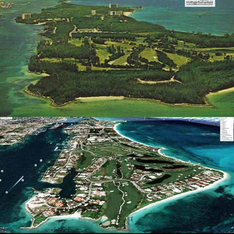
There is so much going on here from a sustainability perspective. The coastlines have been altered changing the deposition of sand and potentially smothering nearby coral reefs. The removal of forested areas is problematic, but much of the internal area was golf course and what seems to be invasive Casuarina trees.
Newly created marinas and waterways do create additional habitat for some waterfowl and the marinas do hold many diadema and in some cases lobster which have been severely impacted in the past, but the question of runoff, waste removal/disposal, and sheer volume of visitors has significant impact on the native environment.
In light of all of this, we also have to take a balanced view and recognize the jobs created by these developments and therefore the growing dependence of Bahamians and the Bahamas on this island. most voting Bahamians today do not recognize the Bahamas of the 1970s so from a cultural perspective, these images may have little weight. Economically and environmentally, we have poor records of the species there now or the species lost during these transitions.
Do you have any impressive old photos of the Bahamas? share with us and let us see the difference between now and then.

Leave a comment